日時 / Date
Sep 18, 2014 (Thu) 13:30-17:00
場所 / Venue
東京大学柏キャンパス総合研究棟412号室(中会議室) / Rm. 412, CSIS (Research Complex Bldg.), Kashiwa Campus, Univ. Tokyo
言語 / Language
英語 / English
講演者 / Speakers
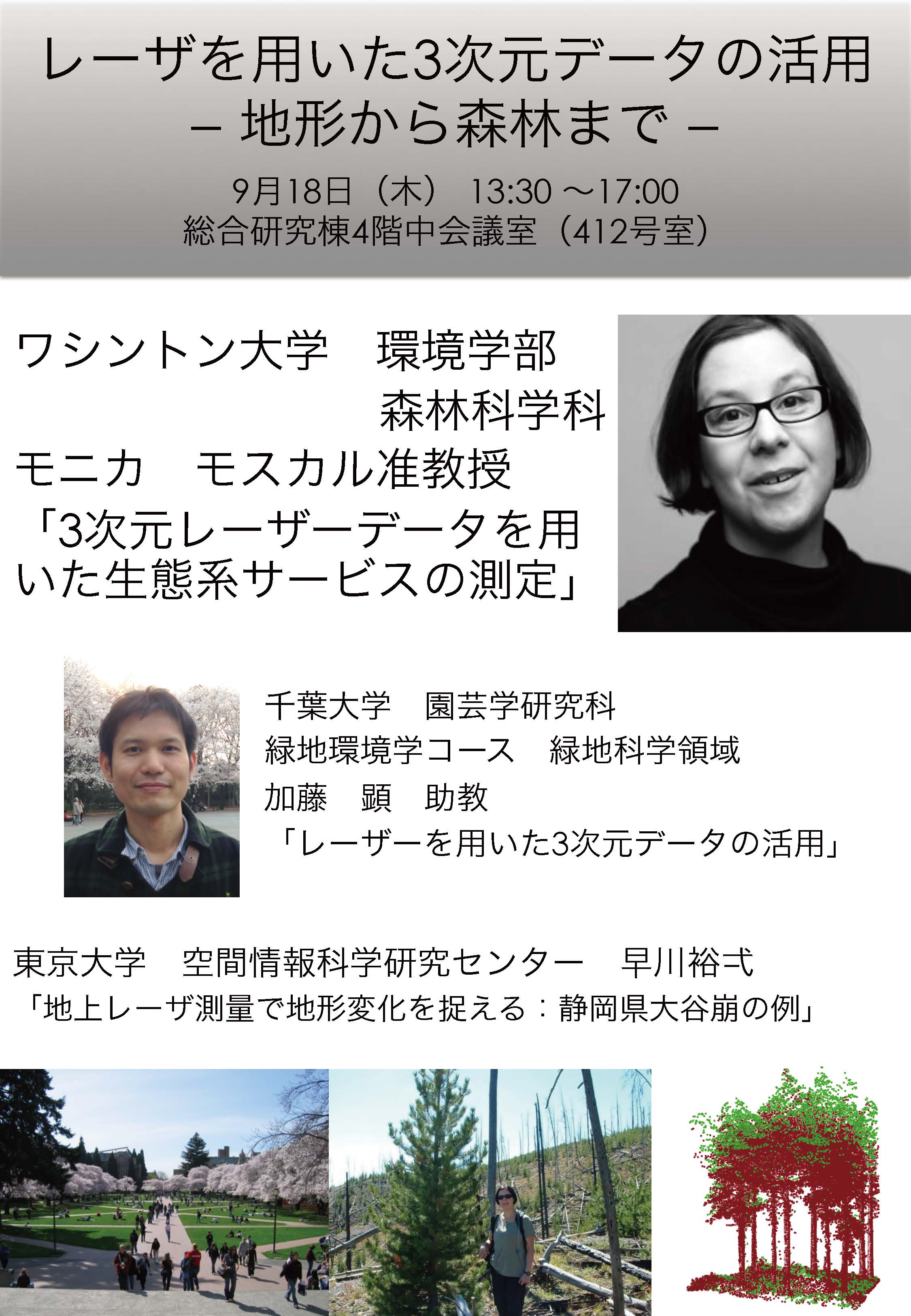
Monika Moskal (University of Washington), Akira Kato (Chiba University), Yuichi S. Hayakawa (The University of Tokyo)
プログラム / Program
- 早川裕弌 / Yuichi S. Hayakawa
地上レーザ測量で地形変化を捉える:静岡県大谷崩の例 / Capturing landform changes by TLS: a case study at Ohyakuzure landslide
- 加藤 顕 / Akira Kato
レーザーを用いた3次元データの活用 / Applications of three-dimensional data by LIDAR
- モニカ モスカル / Monika Moskal
3次元レーザーデータを用いた生態系サービスの測定 / LIDAR for the measurement of forest ecosystem services
laser measurement seminar 14.0918 - Spherical Image - RICOH THETA